Aerial survey 2003
Results of the aerial survey
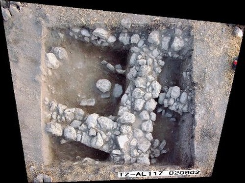
In the 2003 campaign, Jens Kleb introduced the digital photogrammetry of excavation squares on the
tall. It proved to be efficient and fast – but also showed there was a need for some technical refinements. The photos, which had to be rectified, were assembled into maps and could then be related to the excavated strata.
 Jens Kleb: rectified square AL 117
The accuracy of the photos is very good, but an evaluation has to be made jointly by a surveyor and the archaeologist in charge of the relevant square in order to ensure a correct interpretation of the data. In future campaigns, possible sources of error, such as additional distortion caused by the lens and deeply dug squares, will be addressed and the results tested for practicability and precision.
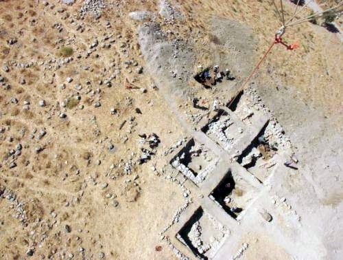
As the BAI is committed to the use of new technologies and their development for application in archaeology, another novelty was applied for the first time. A camera platform, fixed to a helium-filled balloon and completely remote controlled, produced pictures taken from a height of 135 m and covering an area of up to 15,000 m². These serve as photogrammes providing specific site/ground data as well as a reliable overall view of the excavation area and its surroundings. A photomontage of the rectified pictures has been generated with the help of control points.

The camera’s position was navigated via a TFT monitor or head display which proved extremely useful during strong solar radiation. The use of a relatively small balloon for this purpose turned out to be an advantage.
Last updated: 2003
|
CURRENT NOTE (2017) The results of the excavation campaigns from 2003 to 2011 are represented in detail in the final publication. |
 Close Window
 print
print