Campaigns
Methodology (project description 2003)
A comprehensive investigation of the region south of Gadara requires:
- an exploration of the lower Wadi al-'Arab surface (survey),
- a
geophysical survey of Tall Zira'a,
- the excavation of Tall Zira'a and
- an investigation of sites in the surrounding area that are of archaeological significance.
a) The exploration of the lower Wadi al-'Arab surface (survey)
Based on former archaeological surveys of the wadi, the whole area will be mapped, showing all ancient features (i.e. cisterns, terraced structures, agricultural installations and settlement traces) and providing an exact overview of pottery types (in chronological order) and their find spots.

b) The geophysical survey of Tall Zira'a
The actual excavation was preceded and continues to be supplemented by geophysical surveys. Because of the surface conditions, that render geomagnetic measurements impossible, the BAI uses geoelectric exploration methods as applied in nearby Sal. This method has the following advantages:
- Excavations can be conducted in places that have been carefully selected beforehand, thus providing precisely delineated excavation areas in line with geophysical results.
- Geoelectric exploration involves a minimum of effort in comparison to an all-out excavation. Using this method, explorations can be extended to all areas of the tall, beyond the actual excavation sites.
- Excavation, which is costly in terms of funds and manpower, can be kept to a minimum and as such leave enough work for future generations to conduct their own research and reappraise our results.
c) The excavation of Tall Zira'a
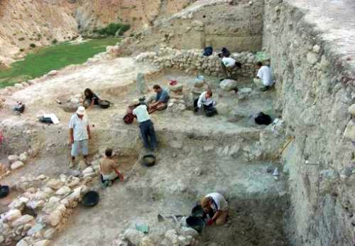
The impressive tall with its still-visible archaeological remains, contains several strata of settlements, some of which were walled. Unique is the spring on the top of Tall Zira'a which, producing a permanent and copious supply of water, ensured excellent settlement conditions on the tall. Moreover, it is protected on three sides by naturally steep slopes. The excavation will also investigate the city walls and glacis of different periods, the areas adjoining the gate to the north and a lower city that is possibly located to the south of the tall. The excavations thus far show a continuous sequence of settlement activity from the Early Bronze Age to the Middle Ages, which will produce valuable insights into the Gadara / Umm Qais region in the pre- and post-classical periods.
In the long term, after securing and restoring the excavated architecture, our aim is to make the tall an archaeological monument which will be accessible to visitors.
 Close Window
 print
print